Volume: 135 L 容积:135 升
Dimensions: 90x50x30 cm 尺寸:90x50x30 厘米
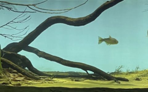
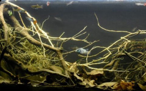
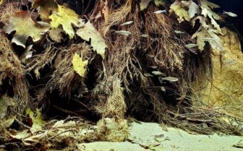
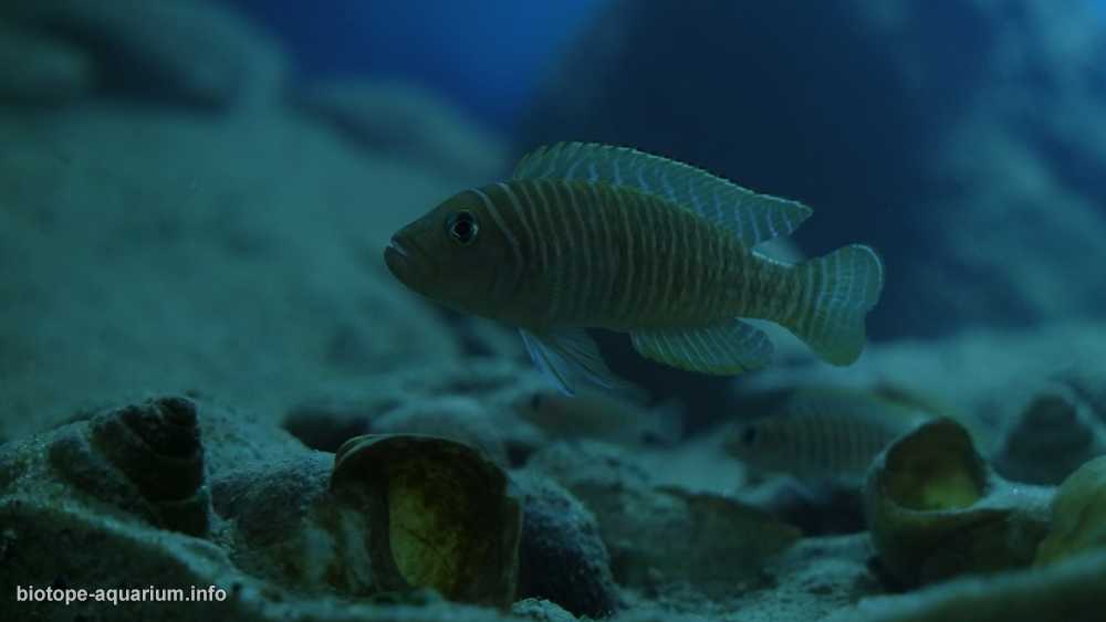
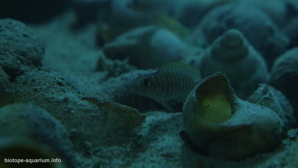
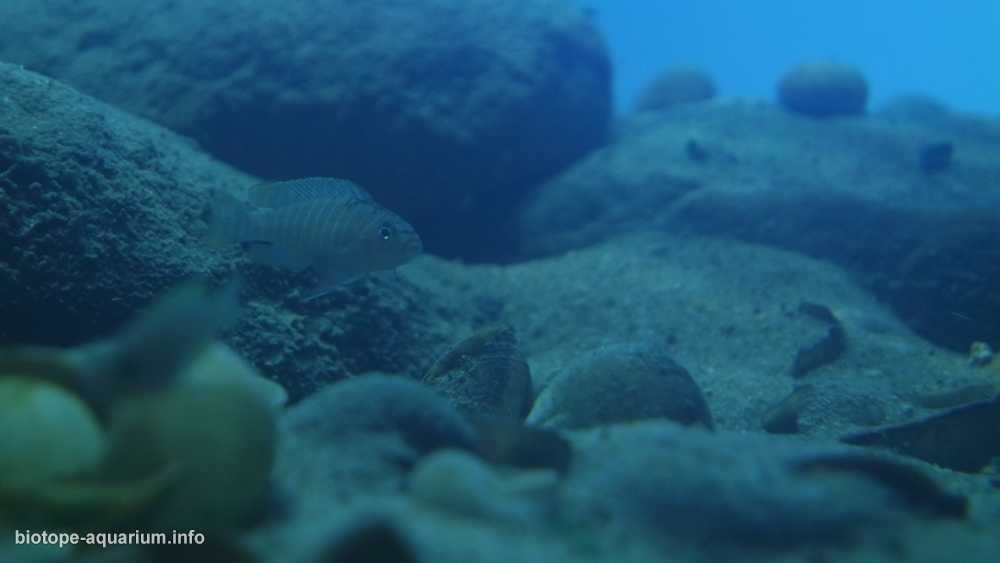
List of fishes: Neolamprologus similis
鱼类名录:贝氏新亮丽鲷(Neolamprologus similis)
List of plants: N/A 植物名录:无
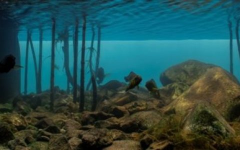
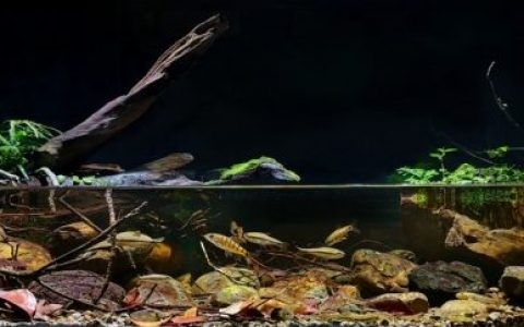
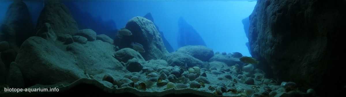
Description of decorations: The ground is made of a mixture of sand to make it look like the bottom of the lake. The decoration was made of stones, shells and artificial rocks imitating those in nature. The blue color is deliberately obtained to show the depth of the biotope. Arrangement is an attempt, a copy of a natural biotope.
造景描述:底床由混合沙质构成,以模拟湖底地貌。装饰物采用石块、贝壳及仿天然形态的人造岩石。特意营造的蓝色调旨在展现该生物栖息地的深邃感。整体布局力求复刻自然生境。
Description of equipment: Aquael Ultramax 1500, Lighting: LED 40W 6500k.
设备描述:Aquael Ultramax 1500 过滤器;照明:40 瓦 6500K LED 灯。
Water parameters: Temperature is 25°C, pH 8,5-9, GH 10, KH 19.
水质参数:温度 25°C,pH 8.5-9,GH 10,KH 19。
Additional info: Water changes once a week 20%
补充信息:每周换水一次,换水量为 20%。
INFORMATION ABOUT BIOTOPE
关于生物群落的信息
Description of the area surrounding the biotope: Lake in East Africa, one of the Great African Lakes, located in the East African rift zone. The lake is divided among four countries , Tanzania, Democratic Republic of the Congo (DRC), Burundi, and Zambia. It covers an area of 34.4 thousand. km², is the longest freshwater lake in the world and the deepest African lake. The lake is located at an altitude of 773 m above sea level. The average depth is 570 m, while the maximum reaches 1435 m. The lake is located in the tropical climate zone. The average annual rainfall is 200mm. Average annual temperature around 20C. Cape Kabogo is located in Tanzania on the eastern shore of the lake (5 ° 27’42 “S, 29 ° 44’50” E). The described biotope is located in the zone of Litoral.
生物群落周边环境描述:该湖泊位于东非,属于非洲大湖之一,地处东非裂谷带。湖区由四个国家共同管辖,分别为坦桑尼亚、刚果民主共和国(DRC)、布隆迪和赞比亚。其面积为 3.44 万平方公里,是世界上最长的淡水湖,也是非洲最深的湖泊。湖面海拔 773 米,平均水深 570 米,最大深度达 1435 米。该湖位于热带气候区,年均降水量为 200 毫米,年平均气温约为 20°C。卡博戈角(Cape Kabogo)位于坦桑尼亚境内的湖东岸(南纬 5°27′42″,东经 29°44′50″)。所述生物群落位于沿岸带区域。
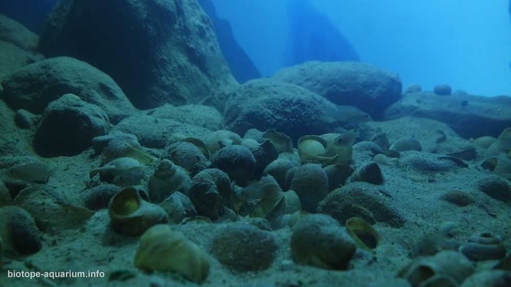
Description of the underwater landscape of the biotope: The bottom is covered with large stones. In the deeper parts the stones are getting smaller and the bottom is covered with sand, mud and clusters of shells, creating an ideal place for small cichlids such as Lamprologus similis, Lamprologus callipterus. Water in lake is very clear, transparency is about 20m.
生物群落的水下景观描述:底部覆盖着大块岩石。在较深区域,岩石逐渐变小,底部则由沙子、淤泥和成簇的贝壳覆盖,为小型慈鲷(如拟贝类短鲷 *Lamprologus similis* 和翼鳍短鲷 *Lamprologus callipterus*)提供了理想的栖息地。湖水极为清澈,透明度约为 20 米。
Description of the parameters of the habitat: The lake’s water is alkaline with a pH of around 9 at depths of 0–100 m, Below this it is around 8.7, gradually decreasing to 8.3—8.5 in the deepest 0parts. Surface temperatures generally range from about 24 °C.
栖息地参数描述:湖泊水体呈碱性,在 0–100 米深度范围内 pH 值约为 9;在此深度以下,pH 值约为 8.7,并随着深度增加逐渐降至最深处(0 部分)的 8.3—8.5。表层水温通常约为 24°C。
List of fishes and invertebrates occurring in the nature biotope: lamprologus similis, Lamprologus callipterus, Cyathopharynx furcifer, Petrochromis sp., Neolamprologus leleupi.
自然生物群落中出现的鱼类和无脊椎动物名录:拟贝类短鲷(*lamprologus similis*)、翼鳍短鲷(*Lamprologus callipterus*)、叉尾杯咽丽鱼(*Cyathopharynx furcifer*)、石首丽鱼属未定种(*Petrochromis sp.*)、雷勒普新亮丽鲷(*Neolamprologus leleupi*)。
List of plants found in the nature biotope: N/A
自然生物群落中发现的植物名录:无
Threats to the ecology: Because of increasing global temperature there is a direct correlation to lower productivity in Lake Tanganyika.[13] Southern winds create upwells of deep nutrient-rich water on the southern end of the lake. This happens during the cooler months (May to September). These nutrients that are in deep water are vital in maintaining the aquatic food web. The southerly winds are slowing down which limits the ability for the mixing of nutrients. This is correlating with less productivity in the lake.
生态面临的威胁:由于全球气温不断升高,坦噶尼喀湖的生产力直接受到负面影响。[13] 南风会在湖泊南端引发深层富营养水的上涌现象,这一过程主要发生在较冷的月份(5 月至 9 月)。这些存在于深层水体中的营养物质对维持水生食物网至关重要。然而,南风风速正在减缓,限制了营养物质的混合能力,这与湖泊生产力下降密切相关。
本文部分素材来自网络,如有类似请联系修改,如若转载,请注明出处:http://www.yangyubang.com/?p=3473