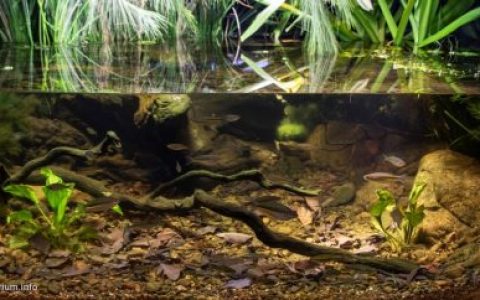
Volume of aquarium: 150 liters
水族箱容积:150 升
Dimensions of aquarium: 85x40x45
水族箱尺寸:85x40x45
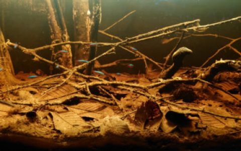
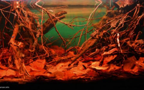
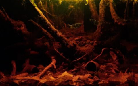
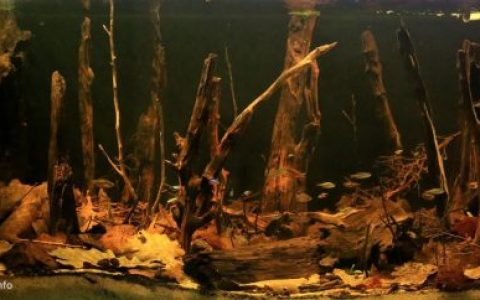
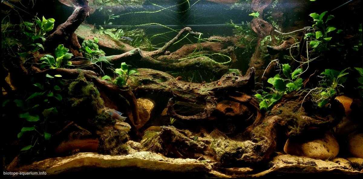
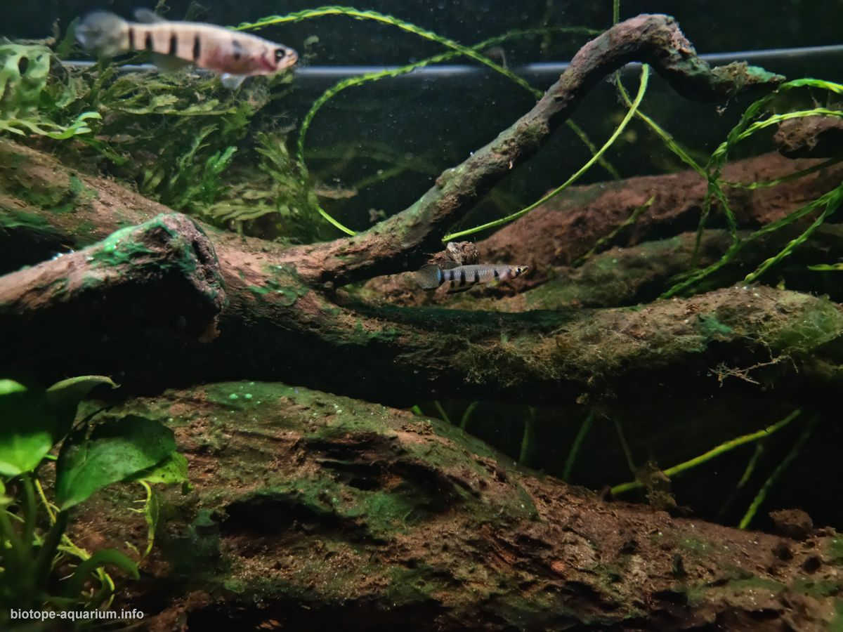
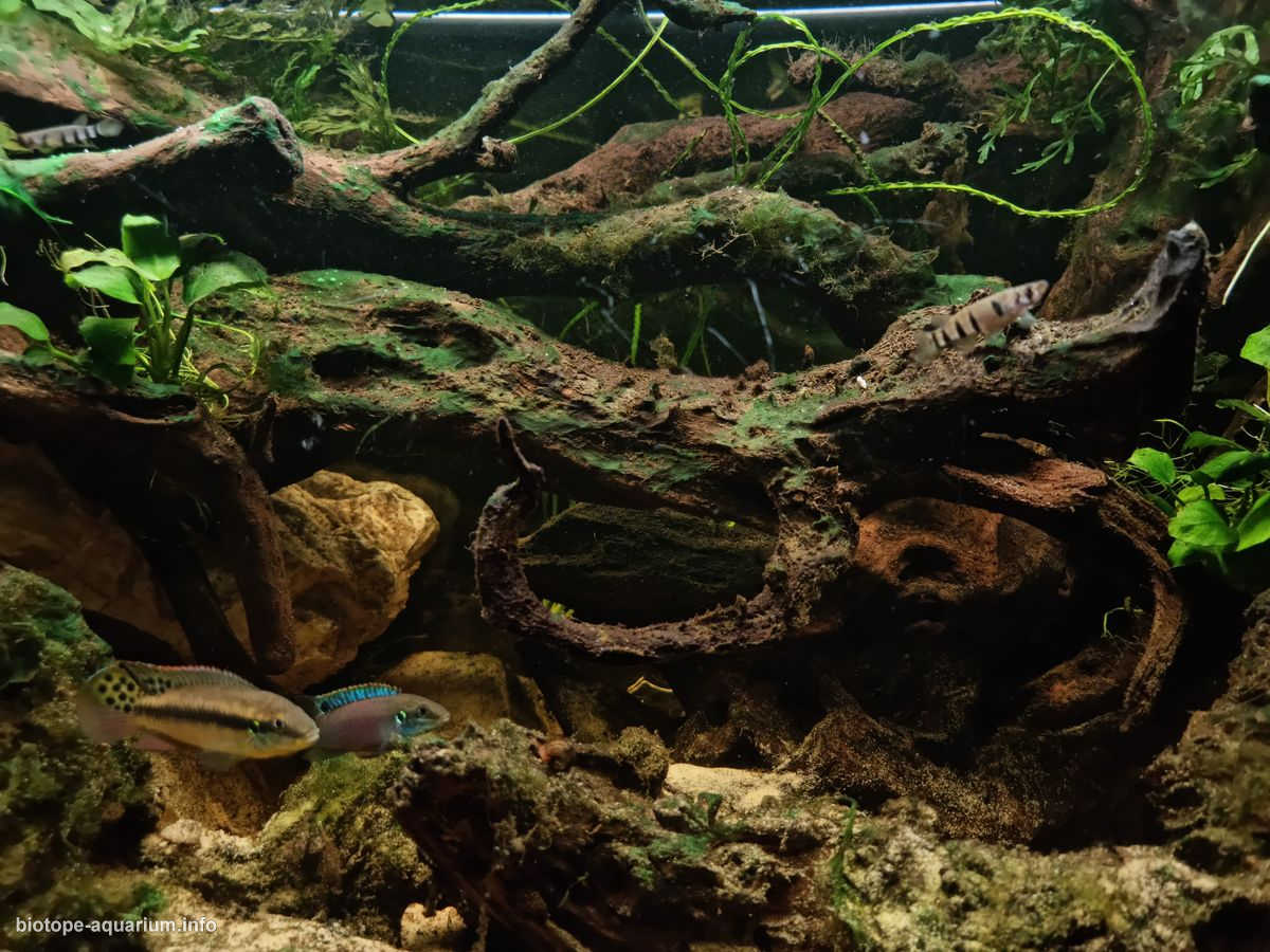
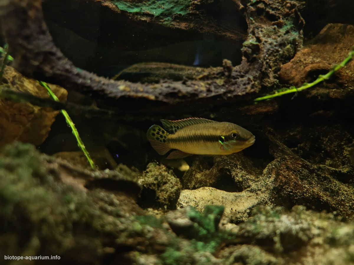
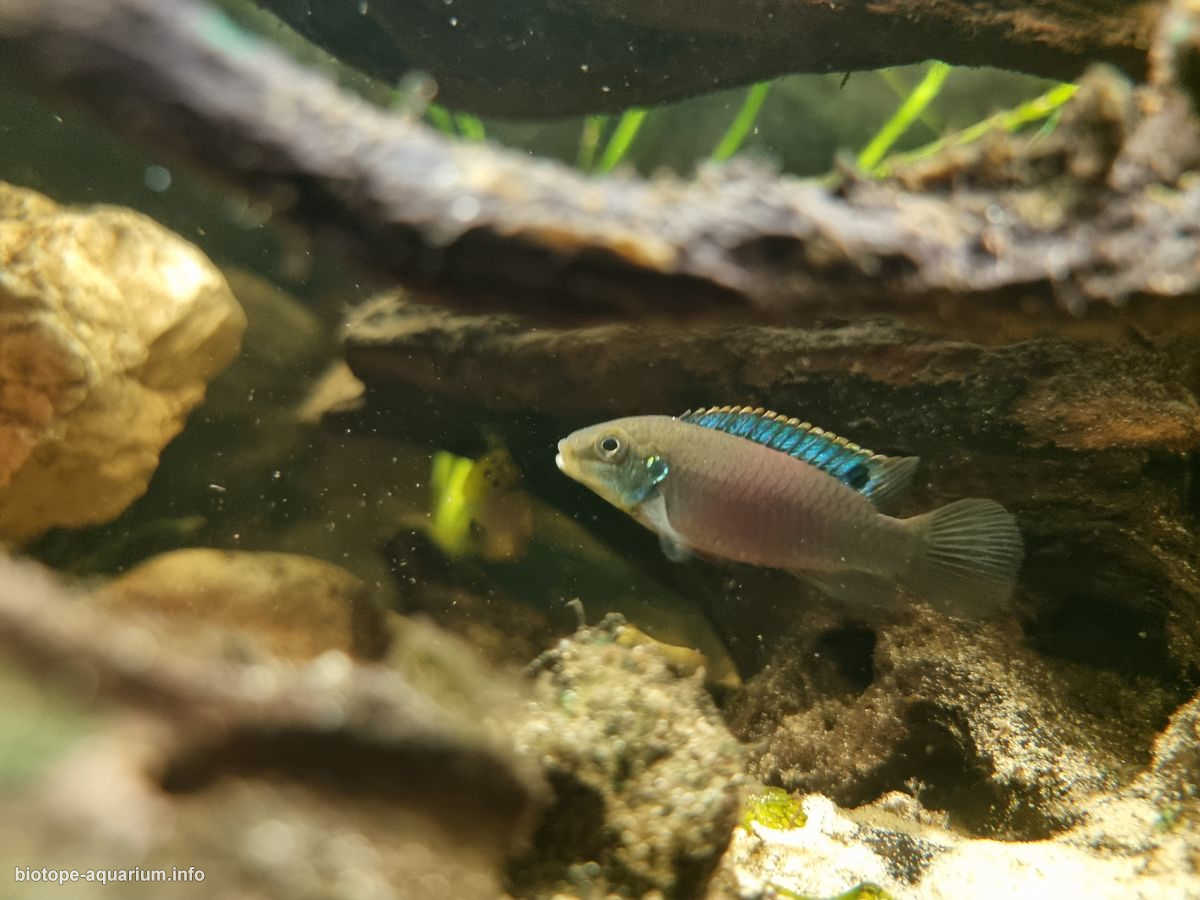
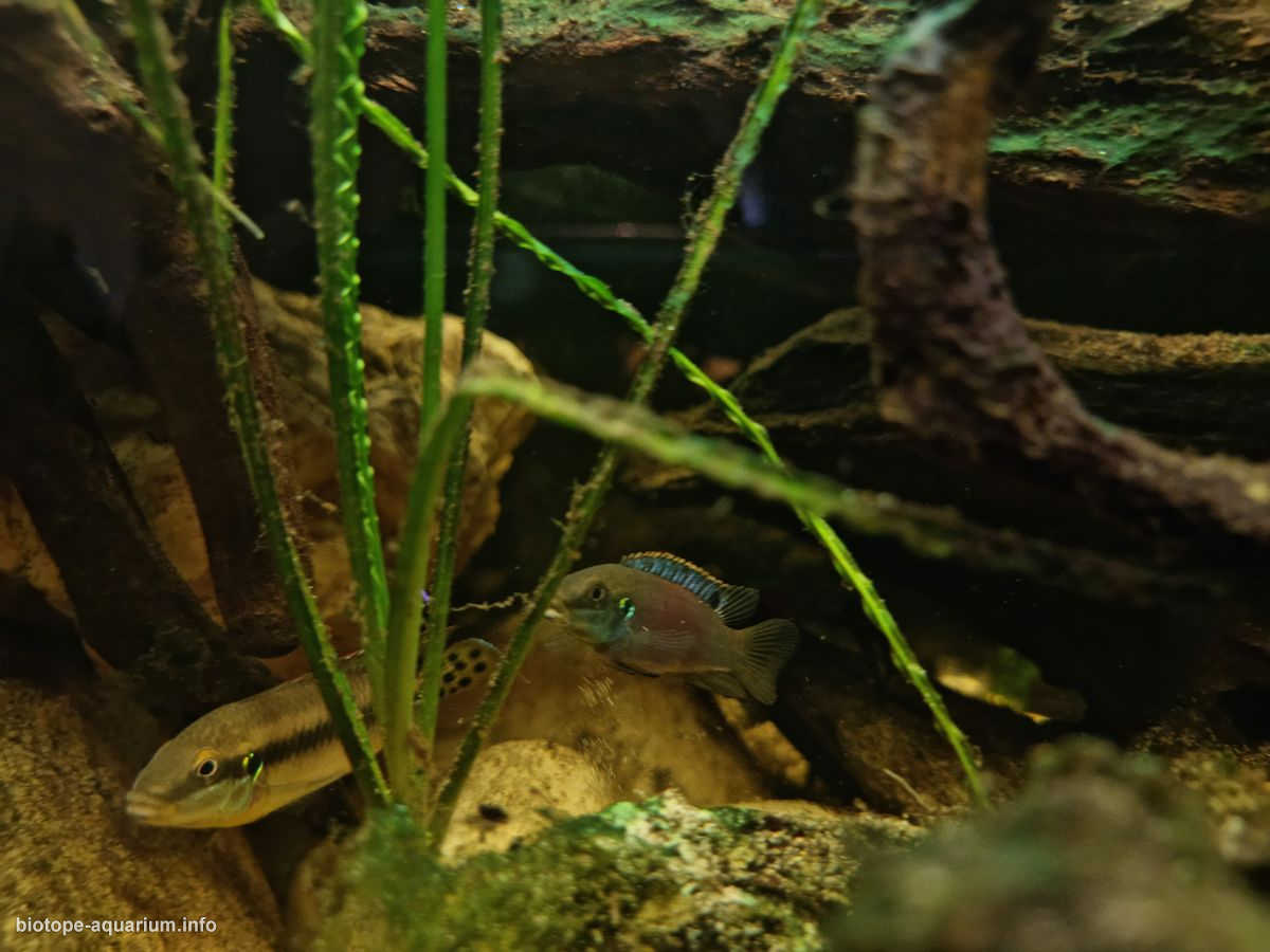
List of fishes: Enigmatochromis Lucanusi x2 ; Epiplatys dageti x8
鱼类名录:Enigmatochromis Lucanusi x2;Epiplatys dageti x8
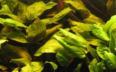
List of plants: Anubias sp. ; Bolbitis heudelotii ; Crinum calamistratum
植物名录:Anubias sp.;Bolbitis heudelotii;Crinum calamistratum
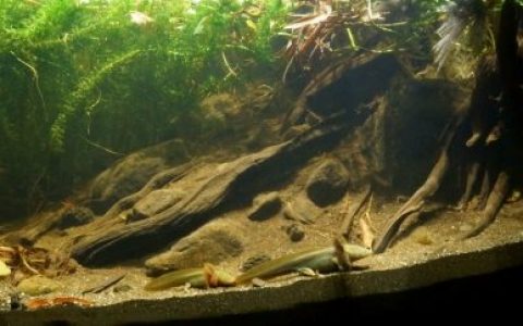
Description of Decorations and Substrate: BASE COMPOSED OF EXTRA-FINE SAND + DRY LEAVES + VARIOUS DRY WOODS + RIVER STONES
装饰与底床描述:基底由超细沙、枯叶、多种沉木及河石组成
Description of Equipment: FILTER: JBL CristalProfi E702 Greenline
设备描述:过滤器:JBL CristalProfi E702 Greenline
LIGHT: 1 LED 5000°K 24W
照明:1 盏 5000°K 24W LED 灯
Water Parameters: Ph 6.5 水质参数:pH 6.5
Kh 1
Temp. 24°C 温度 24°C
Additional Info: Water change once a week 10% with RO
附加信息:每周更换 10% 的反渗透水(RO)。
Description of the Area Surrounding the Biotope: Foto river is near Fria, it is a town and Sub-prefecture in Lower Guinea, lying north of Conakry near the Amaria Dam on the Konkouré River.
生物栖息地周边环境描述:福托河位于弗里亚附近,弗里亚是下几内亚的一个城镇和次 prefecture,位于科纳克里以北,靠近孔库雷河上的阿马里亚大坝。
In the Fria city there is an bauxite-aluminum industry
在弗里亚市有一个铝土矿 – 铝工业。
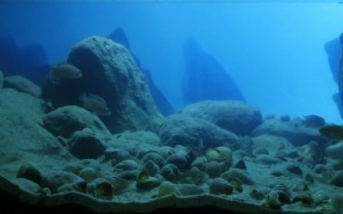
Description of the Underwater Landscape of the Biotope: Foto river is an affluent of The Konkouré River that arises in west-central Guinea and flows into the Atlantic Ocean.[1] Several dams on the river provide the country with much of its electricity.
生物群落水下景观描述:福托河是孔库雷河的支流,发源于几内亚中西部,最终注入大西洋。[1] 该河上建有多座水坝,为该国提供了大部分电力。
The konlkoure river originates in the Futa Jallon highland region and flows in a westerly direction 303 kilometres (188 mi) to the Atlantic Ocean north of the Baie de Sangareya (Sangareya Bay)[1] at 9°46’N, 14°19’W.[2] The Kakrima River is its major tributary.[2] The river delta covers 320 square kilometres (120 sq mi).[3] The “Lower Konkouré is a shallow, funnel shaped, mesotidal, mangrove-fringed, tide dominated estuary”.[4] Rice farms have been established in the mangrove areas of the delta “with some success
孔库雷河发源于富塔贾隆高原地区,向西流经 303 公里(188 英里),在桑加雷亚湾(Baie de Sangareya)以北的北纬 9°46’、西经 14°19’处注入大西洋 [1][2]。卡克里马河是其主要支流 [2]。该河三角洲面积为 320 平方公里(120 平方英里)[3]。“下孔库雷河段是一个浅水、漏斗形、中潮型、红树林环绕且受潮汐主导的河口”[4]。在三角洲的红树林区域已成功建立了一些稻田。
Foto river It is a small savannah river near the bauxite mining town of Fria in north Conakry of Guinea
福托河是位于几内亚科纳克里北部铝土矿开采城镇弗里阿附近的一条小型稀树草原河流。
Description of the Habitat Parameters: Ph 5.8
栖息地参数描述:pH 5.8
Kh 1
Temp.24°C – 30°C 温度:24°C – 30°C
List of Fishes and Invertebrates Occurring in the Nature Biotope: Enigmatochromis Lucanusi ; Epiplatys dageti ; pelvicachromis humilis
自然生境中出现的鱼类和无脊椎动物名录:Enigmatochromis lucanusi;Epiplatys dageti;Pelvicachromis humilis
List of Plants Found in the Nature Biotope: Anubias sp. ; Bolbitis heudelotii ; Crinum calamistratum , vallisneria sp. ; Pistia strationes
自然生境中发现的植物名录:Anubias sp.;Bolbitis heudelotii;Crinum calamistratum、Vallisneria sp.;Pistia stratiotes
Threats to the Ecology of the Biotope: There are many protected areas in Guinea (forêts classées), although little is done to enforce environmental protection regulations. The Mount Nimba Nature Reserve, in the far south-east of the country, along the border with the Ivory Coast, is classified as a World Heritage Site by UNESCO, which however has not prevented the government from opening an iron mine on the mountainside. Also nearby is the Forêt Classée de Ziama, where the rainforest remains untouched (at least for the moment) and elephants are often seen. The future of the two national parks, Parc Transfrontalier Niokolo-Badiar, near Koundara, and Parc National du Haut Niger, northeast of Faranah, is uncertain due to lack of funds.
该生物栖息地生态面临的威胁:几内亚境内有许多保护区(classées 森林),但环境保护法规的执行力度却十分薄弱。位于该国东南端、与科特迪瓦接壤的宁巴山自然保护区已被联合国教科文组织列为世界遗产,然而这并未能阻止政府在山区开采铁矿。附近还有齐阿马分类森林,那里的热带雨林至今未受破坏(至少目前如此),且常有大象出没。由于资金匮乏,两座国家公园——位于孔达拉附近的尼奥科洛 – 巴迪亚尔跨境公园,以及法拉纳东北部的上尼日尔国家公园——的未来充满不确定性。
The data relating to Guinea’s environmental protection are alarming. The population of almost all animal species is constantly decreasing and for most of the flora and fauna no basic data has ever been collected. The main problem is deforestation. The repatriation of most refugees has alleviated the problem of logging to make way for agricultural land, but logging continues, favored by the near total lack of controls, and is advancing so rapidly in the south that the Forest Region deserves a new name. . Along the coast, much of the mangrove forest has been cleared to make way for rice cultivation and unregulated fishing is becoming more and more of a problem. Large mining companies have pledged to improve mining methods and some signs that this is actually happening are already beginning to show.
几内亚环境保护的相关数据令人担忧。几乎所有动物物种的种群数量都在持续减少,而大多数动植物至今尚未收集到任何基础数据。主要问题是森林砍伐。虽然大多数难民的遣返缓解了为开辟农田而进行的伐木问题,但由于几乎完全缺乏监管,伐木活动仍在继续,并在南部地区迅速蔓延,以至于“森林区”这一名称已名不副实。沿海岸线,大片红树林被清除以用于水稻种植,而无节制的捕捞正日益成为严重问题。大型矿业公司已承诺改进采矿方法,一些迹象表明这些承诺正在逐步落实。
本文部分素材来自网络,如有类似请联系修改,如若转载,请注明出处:http://www.yangyubang.com/?p=3587